About a week or so ago I posted a thread on the NJPineBarrens.com forums asking for people’s opinions on what they believed to be the most remote place in the Pine Barrens. When I had first thought of the question, the place that came to mind was the Great Swamp near Batsto. Roads don’t penetrate far into the swamp before they are swallowed up in murky black water, and unless the adventurer feels like slogging through neck high water, or jumping from hummock to hummock it’s almost impossible to cross. With so much featureless, nearly impassible, swampland that it’s likely that there are places there that no human being has ever been to.
I was planning to explore some place unusual – some place that really off the beaten path. I poured over USA Photomaps to try to find a place to explore that fairly inaccessible but wouldn’t require more than a few hours of hiking to get to. I also wanted to actually go to a “place.” A long, difficult hike is no fun unless the destination is something interesting. I wouldn’t have been happy to trek through briars and swamp for a few hours only to find a small, uninteresting clearing – and I certainly would not have enjoyed the trek back.
Another goal was to find some place reasonably close to my house, which disqualifies the Great Swamp and the Southern Pine Barrens. As much as I like Wharton State Forest, it’s a long drive, and there are few places you can go without seeing other people. My search gravitated towards Colliers Mills Wildlife Management Area, which is only forty five minutes or so from my house. The southern part of the tract piqued my interest. I found a road that looked like it passed what might be some abandoned bogs and ruins near High Bridge Road. On the South-Western side of the property, I found what looked like an abandoned cranberry bog and a small mysterious lake without any water systems nearby to feed it. No trails led to the lake, so it would be a nice hike from the abandoned bog. The direction I was going to take was all the better since it crossed a small river – Bordens Mill Branch – and the topo map showed a small strip of swamp on either side of the stream. It would be a nice challenge.
As soon as I got home from having an early Mothers Day dinner with the in-laws I began to plan my trip. I mapped out the waypoint, downloaded them to my GPS, and printed out a copy of the topo map for the area. I hunted around for a backpack that would be small enough to not be a pain to carry, yet large enough to carry my camera, several lenses, food and water, and some other gear. I was excited at the prospect of bushwhacking through the woods, slogging through a swamp, and the challenge of finding my way across the river without getting too wet.
The wheels of my Jeep touched the sand Colliers Mills around 11AM the following day. My first stop was to explore the ruins off High Bridge. The road that I needed forked off High Bridge Road and led deep into the woods near the border of the WMA and Lakehurst Naval Air Station. I was disappointed to find that the trail was well maintained and had fresh tire tracks. I consoled myself by thinking that there was plenty more exploring to be done, and that this was only a diversion from the big adventure of hiking to the “Lost Lake.”
I decided to swing down a smaller path that led through a clearing and then back to the main trail. My GPS was jumping all over the place – first the ruins were on one side of the road, then they’d swing across to the other side. Thinking that it would be easier to find the ruins on foot, I parked the Jeep on the main trail and headed into the woods.
I didn’t have to hike long as the GPS showed the ruins to only be four hundred feet away. Up ahead I saw a clearing. As I walked closer, I began to see bits of rusted metal in the ground. By the time I got to the clearing I could see that I had been there before, when I had driven through it only a few minutes before. I shook my head at my folly and wondered why my GPS had suddenly become so inaccurate.
If there had been anything in this spot, it’s gone now. As I wandered around the clearing I began to wonder about the abandoned bog nearby. I found a break through the trees and walked towards it. The bog was overgrown, but what interested me was the very abandoned road that seemed to parallel the bog. I made a mental note to add this to my list of places to come back and explore at a later date.
I followed the trail back to the Jeep and checked the map. It appeared that the road I was on led all the way into Lakehurst Naval Air Station. Wondering if it would be blocked off by a fence I decided to check it out. Sugar sand was soon replaced by a thick bed of pine needles as I pressed on, and the tell-tale signs of humanity’s presence (litter) disappeared as the woods passed by in a green blur. My mind began to soak in the solitude when a large puddle blocked my path. What looked like a floor mat protruded up above the surface and a long discarded tow strap lay on the opposite side of the puddle. I thought of the people who had been stuck here before and that that they likely had no thoughts or cares for solitude in the woods. I wondered if it was really something that could be found in the Pine Barrens today. It was a thought that hung over my head throughout the day.
Realizing that a puddle with a discarded tow-strap is generally news, I decided to turn around and head towards the other side of the WMA and start exploring the area that was sure to be more remote and wild. I got back to the paved road and turned left at Archers Corner. This brings you through where the town of Colliers Mills once was. Fairly new construction lines the road into the town, and the only original building left from the town is used by the rangers for storage. It’s likely that nobody who lives there now could tell you of the tale of Ephraim P. Emson, founder of Colliers Mills, the two horse tracks he built here, or his ultimate doom by one of his prized steeds.
Going straight past the main entrance to the WMA, the road quickly turns from asphalt to rough sand and follows the lake that formed by damming Bordens Mill Branch to power a sawmill. Today the mill is gone, and the only people nearby are a father and his two young boys fishing on the bank of the lake. They’ve driven here in a Chevy Avalanche pickup, with chrome rims and terrible low-profile tires. You can tell that these people aren’t of the Pines – there’s not even a scratch on the glossy black paint. They watch as my dirty yellow Jeep passes by.
If you were to take this road as far as you can, you’d end up on Hornerstown Road. The road is paralleled by a chain link fence, newly erected to protect Lakehurst NAS. If you could continue further down the road once it crosses onto military property you’d pass close to Boyd’s Hotel, an important stop in the stage route from Hanover Furnace.
Taking a left hand turn, I nudge the Jeep down a precariously narrow road that runs alongside an abandoned bog. The clouds that have been hanging low all morning are starting to clear up. I parked the Jeep in a clearing and set off to find the second abandoned bogs. There’s a road leading to it, but at this point in time I had lost my bearings somewhat so I decided to let the GPS lead the way. Stumbling through the woods, I was able to make my way to the path that led to the bogs. Walking along the long-abandoned road I passed the ruins of what might have been a hunting cabin or building somehow attached to the bog operations. All that remains now is the faint outline of a cinder block foundation, an old cast iron sink, and a well pipe sticking out of the ground. The path leads on, curving around a bend and delving into a puddle before entering a swamp. It became wetter and wetter until finally it ended in a clearing – the bog itself.
It was unlike any bog I had ever seen. First, there was no embankment around the edge of the bog. It was literally a path into a marsh. Instead of open water, vegetation grew throughout. I was able to walk through most of it in my knee boots, although there were a few spots that were deep and tried to suck my boots off. Exiting the bogs and walking around the edge in the swamp, I found a discarded tire and an ancient beer bottle. That, and the sounds of shooting from the WMA nearby, served as a reminder that mankind is never far away in the Pine Barrens.
It was nearly two o’clock when I made my way back to the Jeep. The next part of my adventure was about to start – the hike to Lost Lake. After stopping to rest up and reapply my bug spray I started out on the journey. I dove into the woods with renewed vigor as I was sure I would be exploring a place where nobody has been before. At first the going was easy but soon I found myself surrounded by some sort of small trees or shrubs. I pressed on, forcing myself through the vegetation, cursing myself for wearing short sleeves. Finally, I stumbled on what might have been a deer trail leading in the general direction of the lake. The trail took me down towards the river, and the vegetation became more green, lush and thick.
The topo maps on my GPS informed me that I had entered the swamp surrounding Bordens Mill Branch. I’m not entirely sure why, but the ground was remarkably dry. Water sat only in a few small stagnant pools. It appeared that I was standing in what might have once been a river bed, and I came to the conclusion that I was standing in Bordens Mill Branch and it was now dry. The vegetation on either side of the river was extremely dense and I soon had rips in my jeans from the briars. Exhausted from trying to fight my way through the vegetation, I turned around back to the stream bed and began to follow it in an attempt to find a less overgrown area to trek through. It brought me out to a trail which immediately confused me. As far as the topo map was concerned, there is no road here. This was backed up with the satellite photos that I had poured over the night before. Curious, I followed the road. As much as I hate to admit it, I was happy that I came across the road. I really did not enjoy bushwhacking as much as I thought I was going to.
Soon, a curiosity came into sight. A rude bridge crossed a cedar stream. At once I realized my folly – the dry “river bed” that I had assumed to be Bordens Mill Branch was not in fact anything so important, and this river – crossed by a very convenient bridge – was the river that had once powered the mill at Colliers Mill.
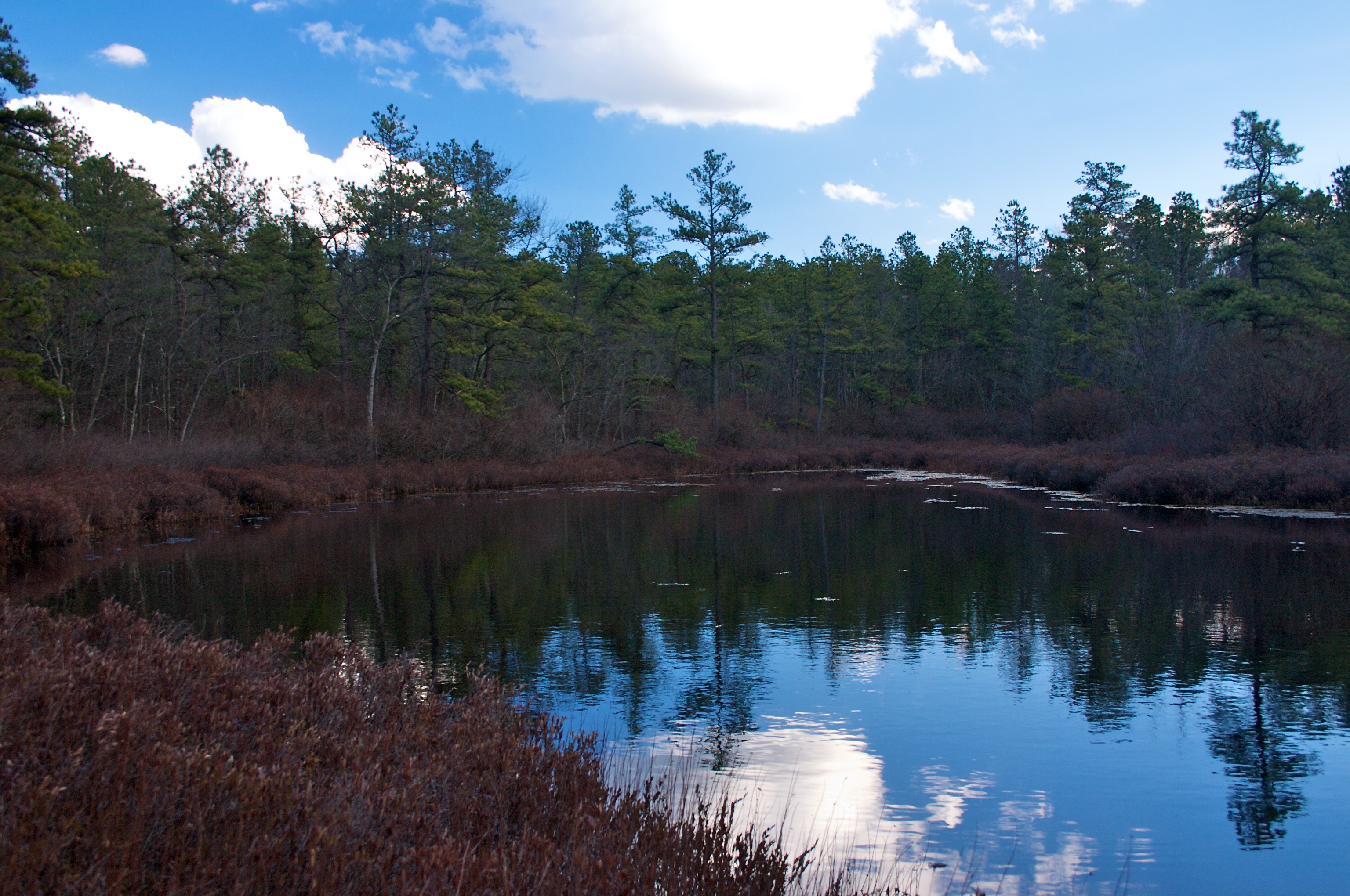
The trail led on through the woods in the direction of the lost lake. As I began to pass trees with bright orange blazes on them I began to get depressed. I felt cheated out of the opportunity to be the first person to visit Lost Lake. The path continued on, passing through a series of clearings and continuing on through the woods. After a half an hour of walking the blazes stopped, and I found myself in another clearing. To my right the land dropped down into swamp, and I could make out pools of standing water in-between the trees. According to my GPS, the lake was only a few hundred feet away. Now very happy that I had my knee boots on, I entered the swamp. Following a small trail of water, I soon found myself on the side of the lake. It was not more than thirty or forty feet long, and perhaps twenty across. The water was already nearly to the top of my boots so I dared not go any further.
Ten minutes later I was back on the trail towards the Jeep. It was late, and I was exhausted and slightly disappointed. It’s very likely that I was not the first person to visit the lake. It’s simply too easy to get to – especially as I found that had I continued to drive down the path that the Jeep was parked on, I would have been able to park right at the bridge I found.
First published on NJPineBarrens.com in 2008
Despite the fact that I was didn’t chart any new territory, it still was an enjoyable day. The area isn’t overrun by people, and you do get a sense of isolation out there, despite the fact that every now and then you’ll see evidence of people being there before. In some ways, the Pine Barrens are ideal for weekend explorers, since help is never truly that far away.